- Previous
- /
- Nepal 2012
- /
- Next
Everest Base Camp Trail
This is the classic Everest Base Camp Trail. Starting from Lukla then climbing through Namche, Tengboche Monastery, Pangbnoche, Lobuche and finally reaching Kala Patthar and the base camp itself.
-

Lukla airport (2800 m)
-
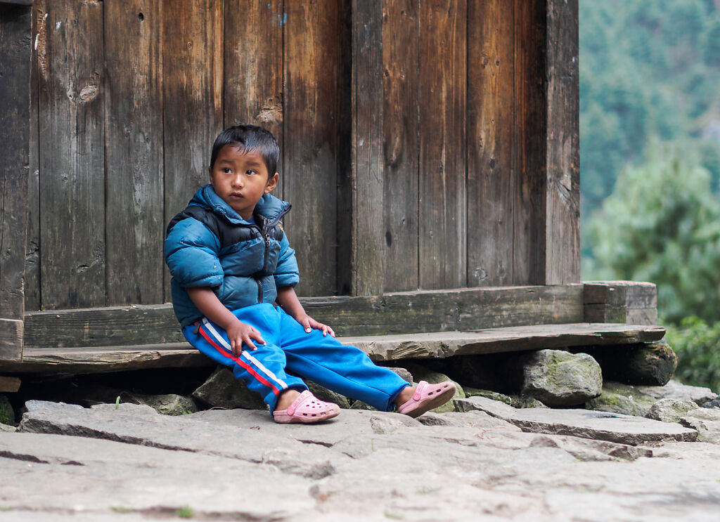
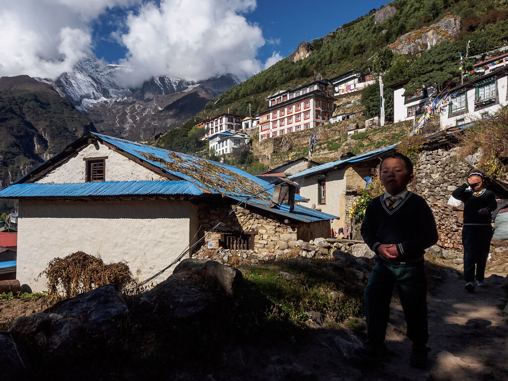
A local boy by the trail
-
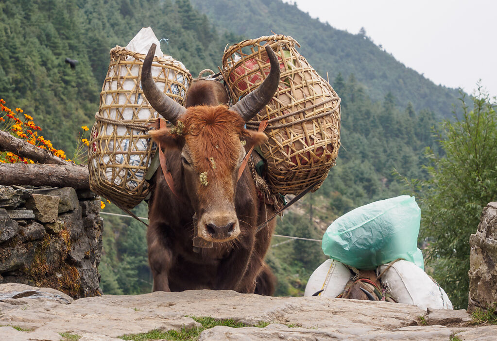
A dzopkyo (cross breed between yak and cow) on the trail above Lukla
-

Kusum Kanguru (6367 m) seen from Ghat
-

Morning views from Phakding. Pema Choling Gompa (monastery) is in the mists below.
-

Kids at Pema Choling Gompa (monastery) playing with our cameras
-
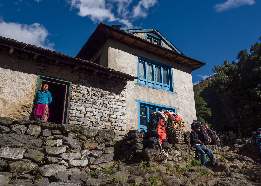
A house by the trail above Pahkding
-

Porters in Benkar
-
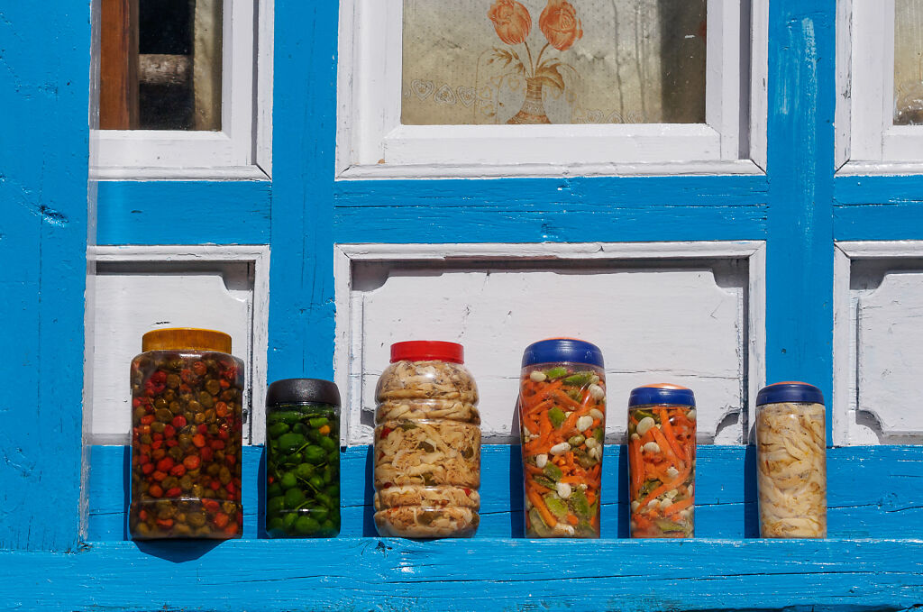
Jars of pickles by the trail
-

Local appleas sold by the trail
-
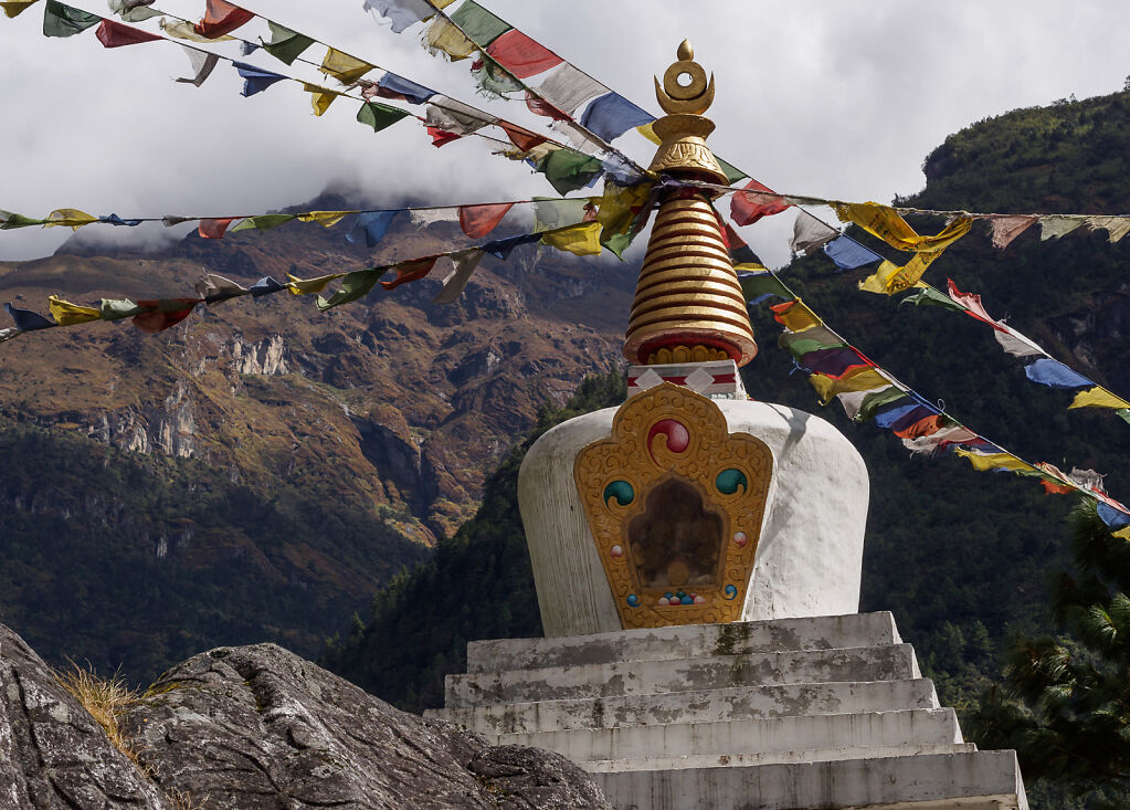
A stupa in Benkar
-

Mt. Thamserku (6608 m) seen from Benkar
-

Local family working their land. Shot near Monjo.
-

A juniper burner in a Jorsale lodge. Tibetan Buddhists burn juniper incense every morning in their houses.
-
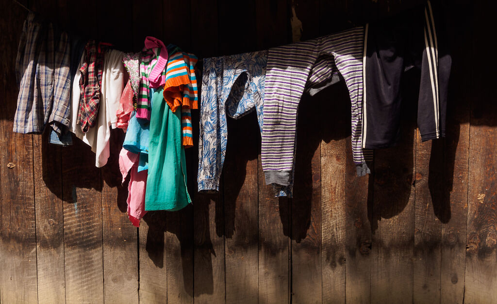
Colorful laundry by the Everest trail
-

The high suspension bridge above the confluence of Dudh Kosi and Bhote Kosi rivers
-

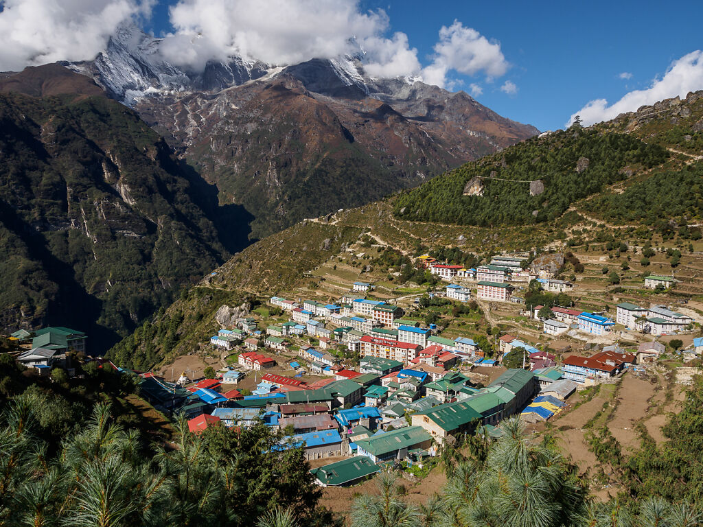
Entering Namche Bazaar (3440 m)
-

Morning in Namche
-
Morning in Namche
-

Everest and Lhotse seen from above Namche
-

Lhotse (8516 m) is the 4th highest mountain on the planet. Its south face is 3200 m-high.
-

Holding Mt. Everest ;-)
-
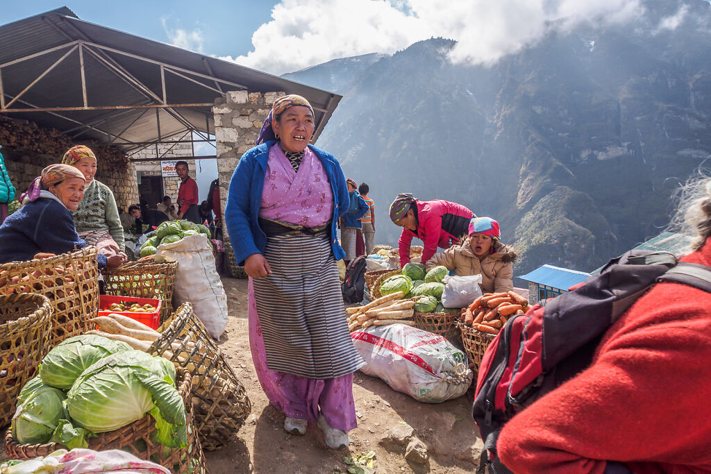
The Saturday market (bazaar) in Namche Bazaar
-

Namche kids doing their homework
-
Kids going to school in Namche
-

Kids going to school in Namche
-

A Namche window
-

A perfect morning in a Namche coffee shop. Mt. Thamserku is in the background.
-

Prayer wheels line the walls of the Namche Gompa (monastery)
-

Night falling over Namche Bazaar. The ice-capped mountains on the horizon are Thamserku (6608 m) and Kusum Kanguru (6367 m)
-

A vendor selling kitchenware to the Khumbu villages. Shot on the trail above Namche.
-

The suspension bridge at Phungi Thanga
-

On the trail below Tengboche
-

Ama Dablam (6812 m) seen through the gate of Tengboche monastery
-

Inside the Tengboche monastery
-

A stupa mirroring Ama Dablam's perfect shape. Shot from the trail to Pangboche.
-

Ama Dablam (6812 m) from the trail to Pangboche
-
Climbers having breakfast in a Pangboche lodge
-

Dingboche (4400 m)
-

A stupa on the hill above Dingboche
-

A stupa on the hill above Dingboche. Ama Dablam (6812 m) is behind.
-

The trail above Dingboche. Ama Dablam (left) and Kangtega (right) are on the horizon.
-

Ama Dablam (6812 m) from above Dingboche
-
Ama Dablam seen through the prayer flags of the memorial site above Dughla.
-

The memorial site above Dughla.
-
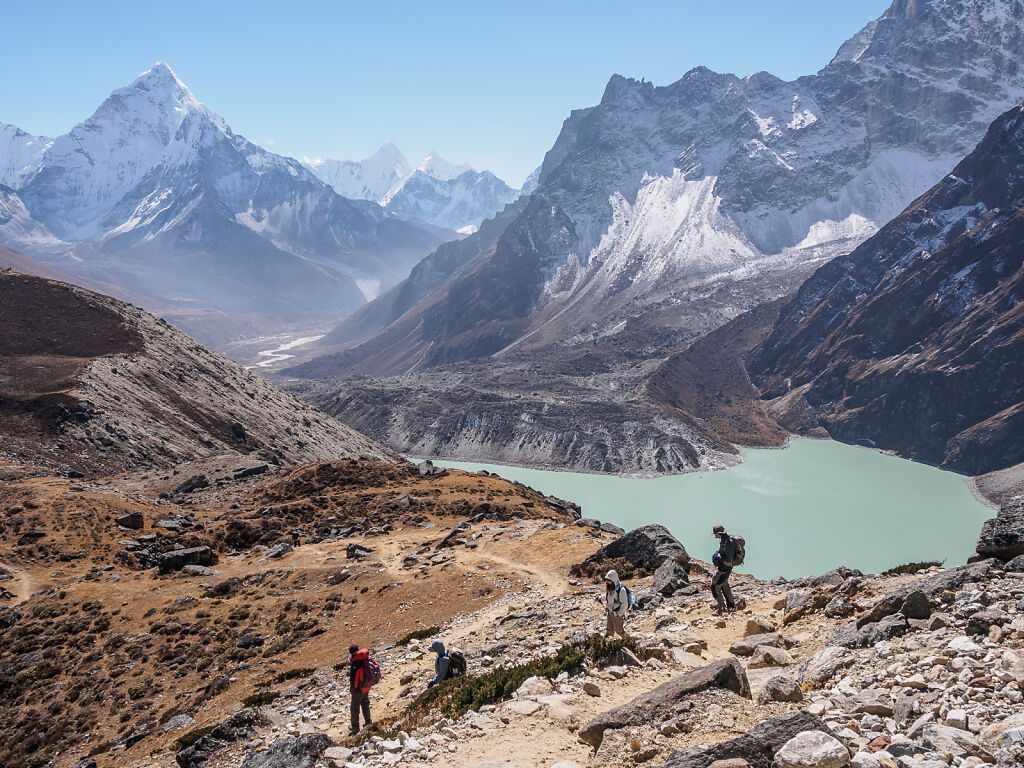
Looking east from below Dzongla. To the right is Chola Tsho (lake).
-

The Everest trail just below Lobuche. On the horizon are Pumori, Lintren and Khumbutse - all on the border with Tibet (China)
-
The Everest trail just below Lobuche. On the horizon are Pumori, Lintren and Khumbutse - all on the border with Tibet (China). To the right is Nuptse (7861 m)
-

A porter carrying pipes with Pumori, Lintren and Khumutse towering behind
-

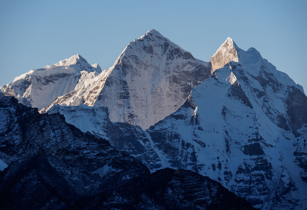
Nuptse seen from Lobuche in the evening
-

Enjoying a late afternoon from the lateral moraine of Khumbu Glacier. The glacier itself is to the right. On the horizon are Pumori (7161 m), Lintren (6713 m), Khumbutse (6639 m), and Nuptse (7861 m)
-

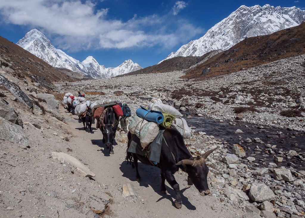
Looking north in the Khumbu Valley in late afternoon
-

Nuptse seen from Lobuche in the evening
-

Pumori before sunset. The black rock still in the sun under it is Kala Patthar (5645 m)
-

Nuptse from Gorakshep
-

Nuptse (7861 m)
-

Everest Base Camp (5350 m)
-
Kangtega (6782 m) - a view from Kala Patthar
-
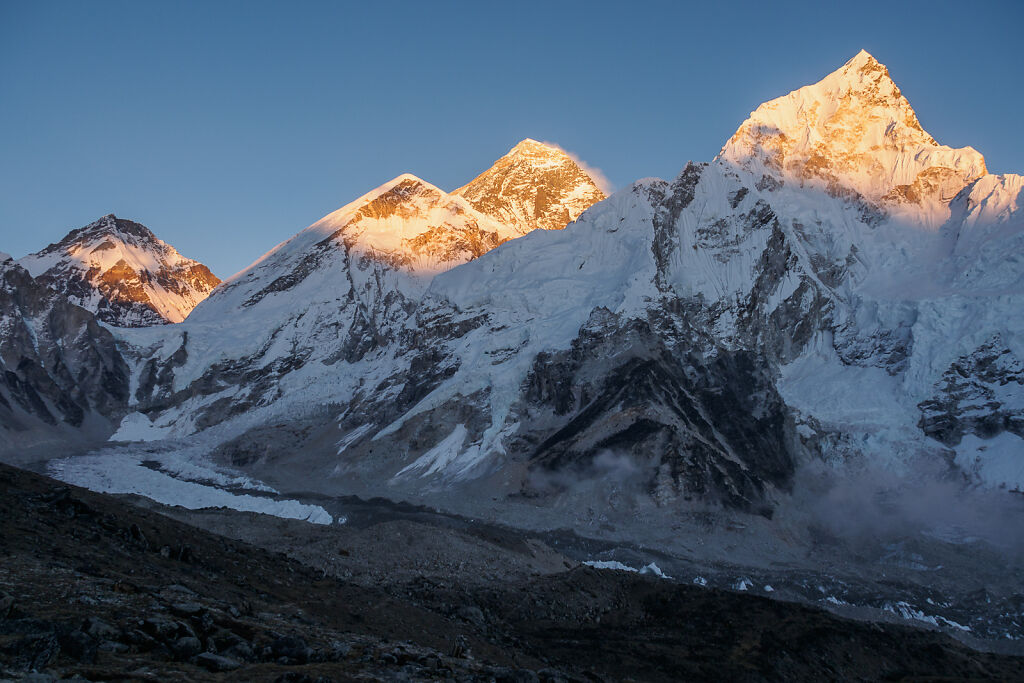
Everest sunset from half way to Kala Patthar. The orange mountains on the horizon are Changtse, Everest's West Shoulder, Everest itself and Nuptse
-

Mt. Nuptse a minute before the sun set
-

Everest sunset from below Kala Patthar
-
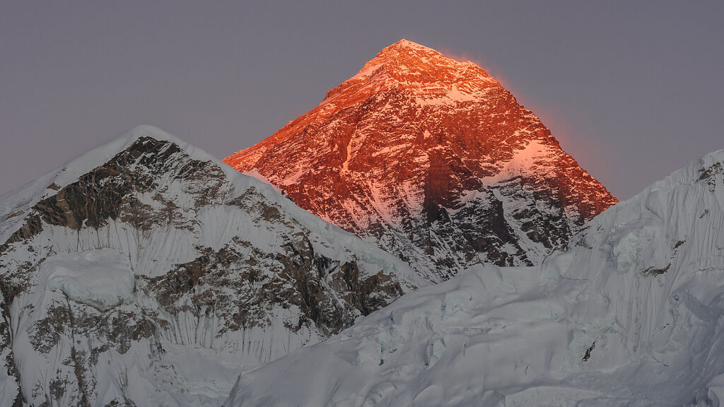
Everest sunset from below Kala Patthar. This is less than a minute before the light goes out completely.