- Previous
- /
- Nepal 2012
- /
- Next
Everest and Gokyo Trek and Island Peak Climb in 100 Pictures
These are the pictures that I find to best capture the spirit of my trip to Nepal in October 2012. The trip included Kathmandu Valley, Everest Base Camp, Thame Valley and Renjo La, Gokyo and Cho La and also climbing of the 6189m-high Island Peak.
-

Buddha eyes stare form the four sides of the big stupa in Bodhnath
-
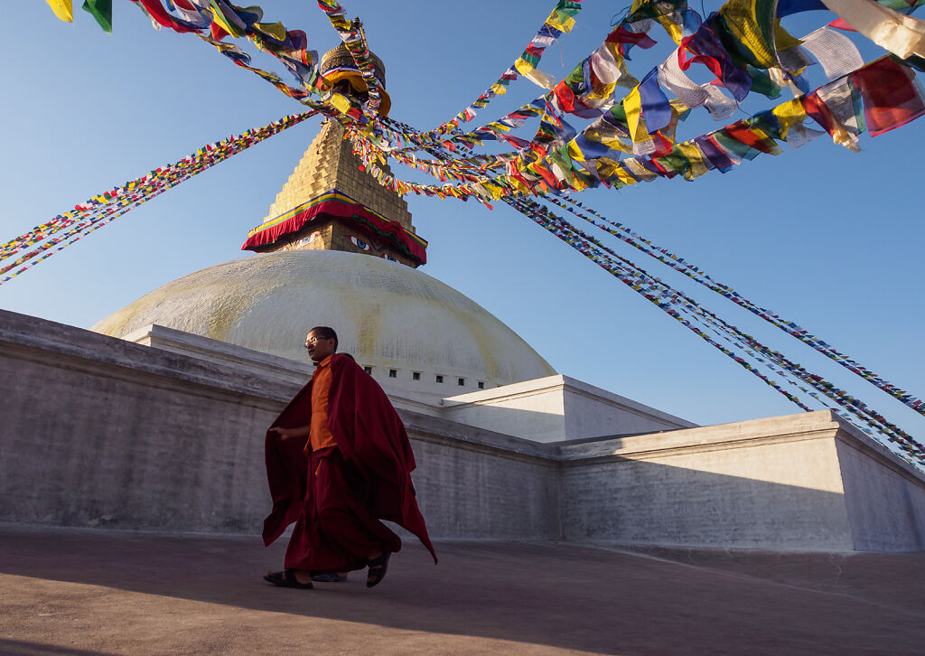
Monks circumambulate the big stupa in Bodhnath
-

Tibetans circumabulate the big stupa in Bodhnath. Bodhnath is the center of immigration of Tibetan expats in Kathmandu.
-
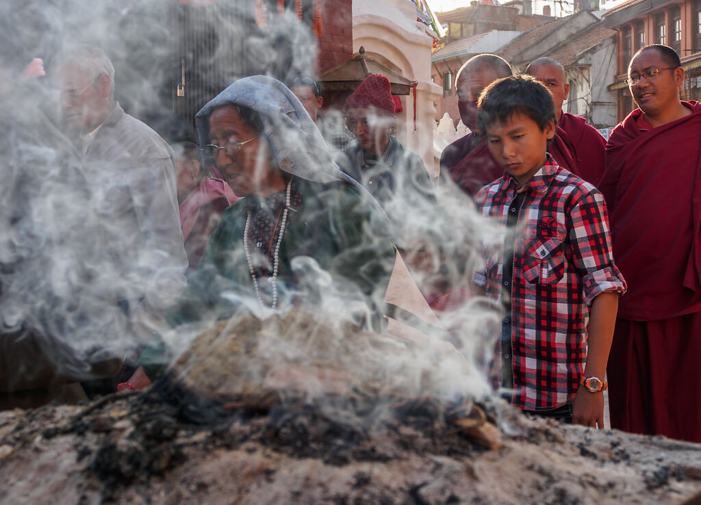
Juniper incense burning in Bodhnath
-

Receiving a blessing at a Bodhnath gompa (monastery)
-
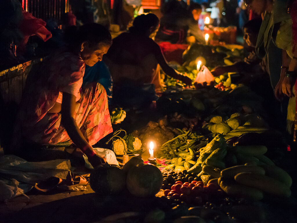
Street market vendors use candles during a blackout in Kathmandu
-
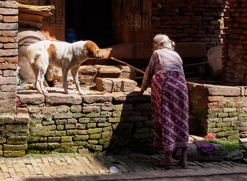
In the streets of Bhaktapur
-

An apprentice in a Bhaktapur thangka school
-

Thangka details. Shot at a thangka shool in Bhaktapur.
-
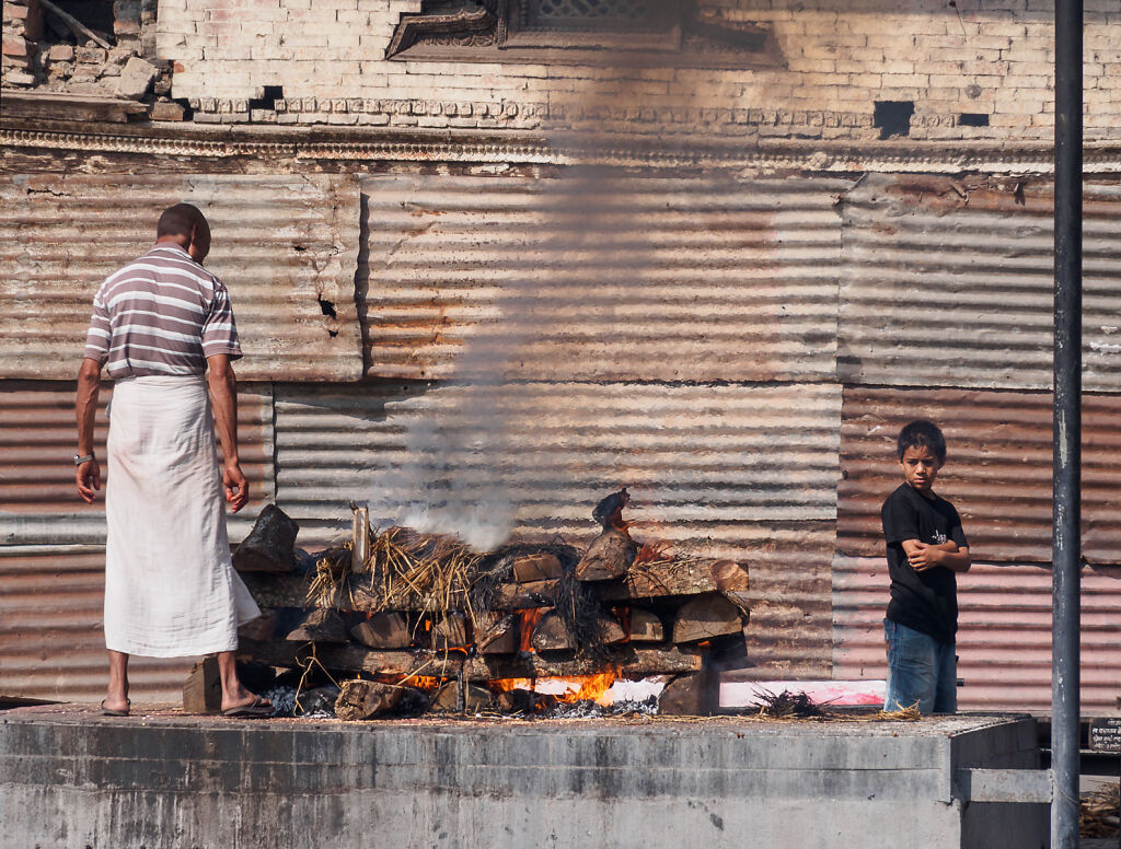
Cremation pyre burning in Pashupatinath
-

A fake sadhu posing for pictures for a few rupees at Pashupatinath
-

At Pashupatinath
-

Swayambhunath, a.k.a. Monkey Temple at sunset
-

A monkey family at the Monkey Temple (Swayambhunath)
-
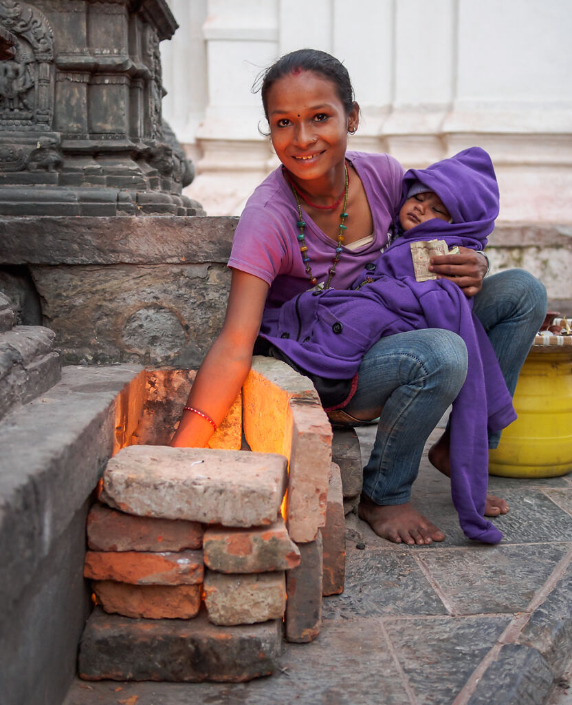
A young woman with her baby selling candles at Swayambhunath
-

Piles of garbage remain on the streets of Patan after the popular Dasain festival
-

To buy or not to buy? That is the question ;-)
-

Patan's Durbar Square
-

The elders of Patan's Durbar Square
-

A juniper burner in a Jorsale lodge. Tibetan Buddhists burn juniper incense every morning in their houses.
-

Local family working their land. Shot near Monjo.
-

Kids at Pema Choling Gompa (monastery) playing with our cameras
-
Mt. Thamserku (6608 m) seen from Benkar
-

Morning in Namche
-

The Saturday market (bazaar) in Namche Bazaar
-
Kids going to school in Namche
-
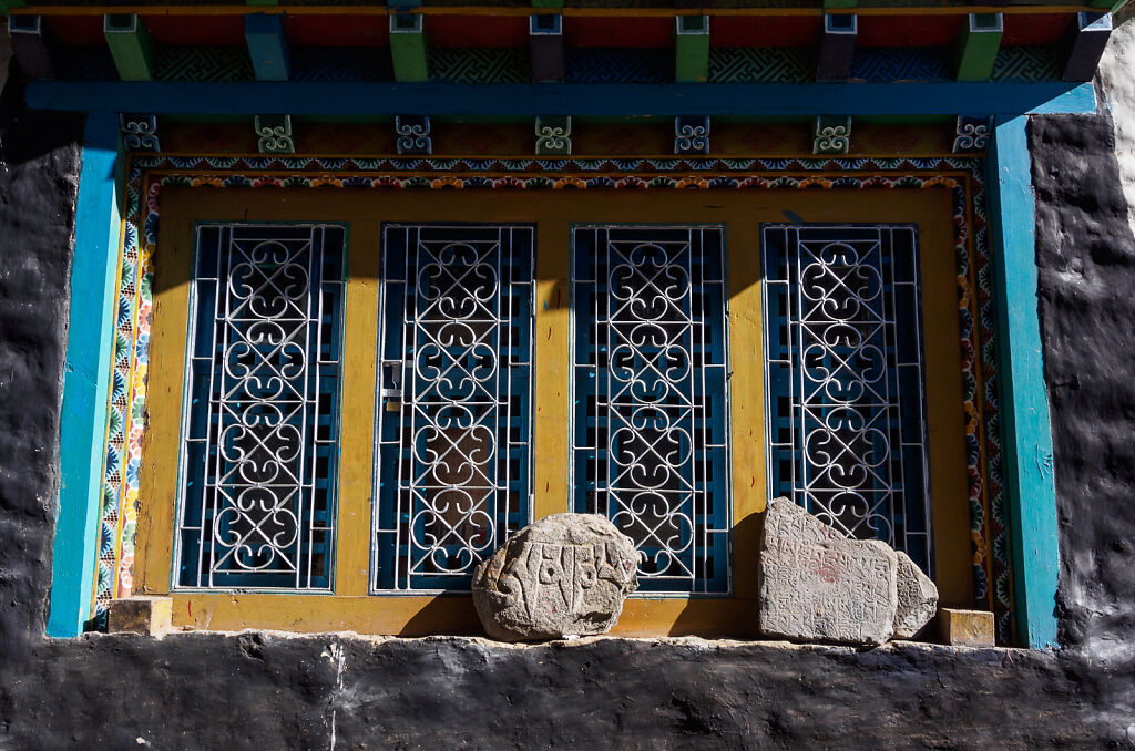
A Namche window
-

Lhotse (8516 m) is the 4th highest mountain on the planet. Its south face is 3200 m-high.
-

Holding Mt. Everest ;-)
-

Looking back east from Thame Valley. Thamserku and Kusum Kanguru are on the horizon.
-

Nuns on the trail to Thame
-
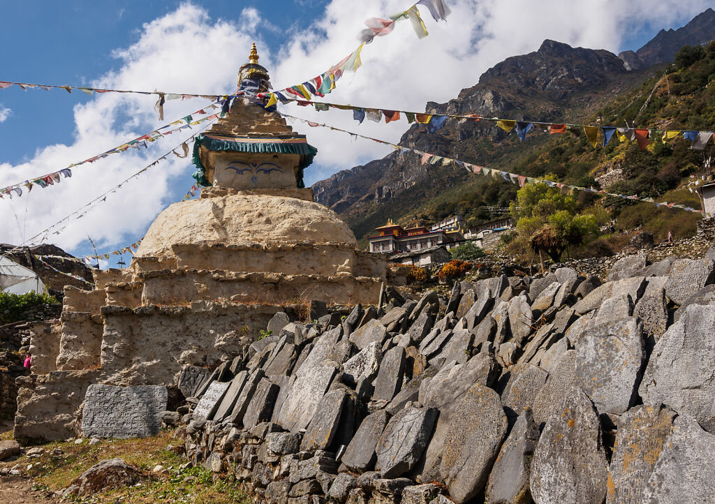
A stupa in Thamo (not to be mistaken with Thame)
-

Thame Gompa (monastery) is located just 20 minutes above the village
-

Monks and kids in Thame Gompa
-

Kids in Thame Gompa. Behind is Tengkangpoche (6500 m) in the clouds.
-

Kangtega and Thamserku just after sunset seen from Thame Gompa
-

Thame village
-

Morning views of Kangtega and Thamserku from Thame
-

Sherpa kid in a Marlung lodge
-

A rest stop high in Thame Valley. Looking north at some 6000 m mountains close to the border with Tibet.
-

A souvenir stand at 4380 m. Shot from just before Lungden.
-

Sun rising over Mt. Tengkangpoche (6500 m). Shot from the trail to Renjo La.
-

Morning views from the trail to Renjo La
-

Sunrise above the trail to Renjo La
-

The last few minutes before Renjo La (pass). We are almost at 5400 m.
-
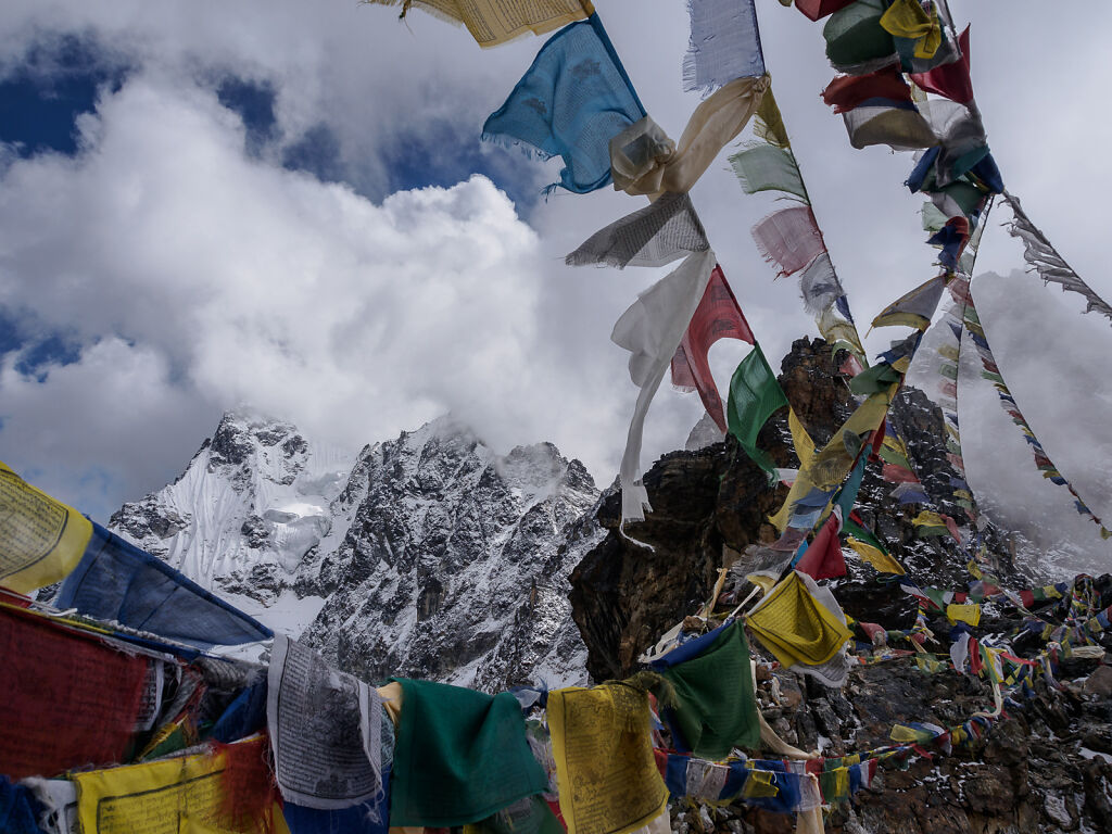
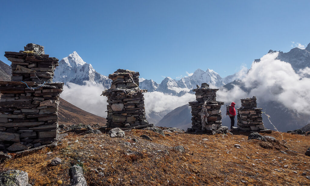
Prayer flags fly over Renjo La (5400 m)
-

One of the best views in Nepal Himalaya - a look east from Renjo La. Mt. Everest, Nuptse and Lhotse are above the clouds. Cholatse is to the right. in the clouds. Below is Gokyo Valley with Dudh Pokhari lake, Gokyo Village and Ngozumpa glacier.
-

The descent east from Renjo La
-

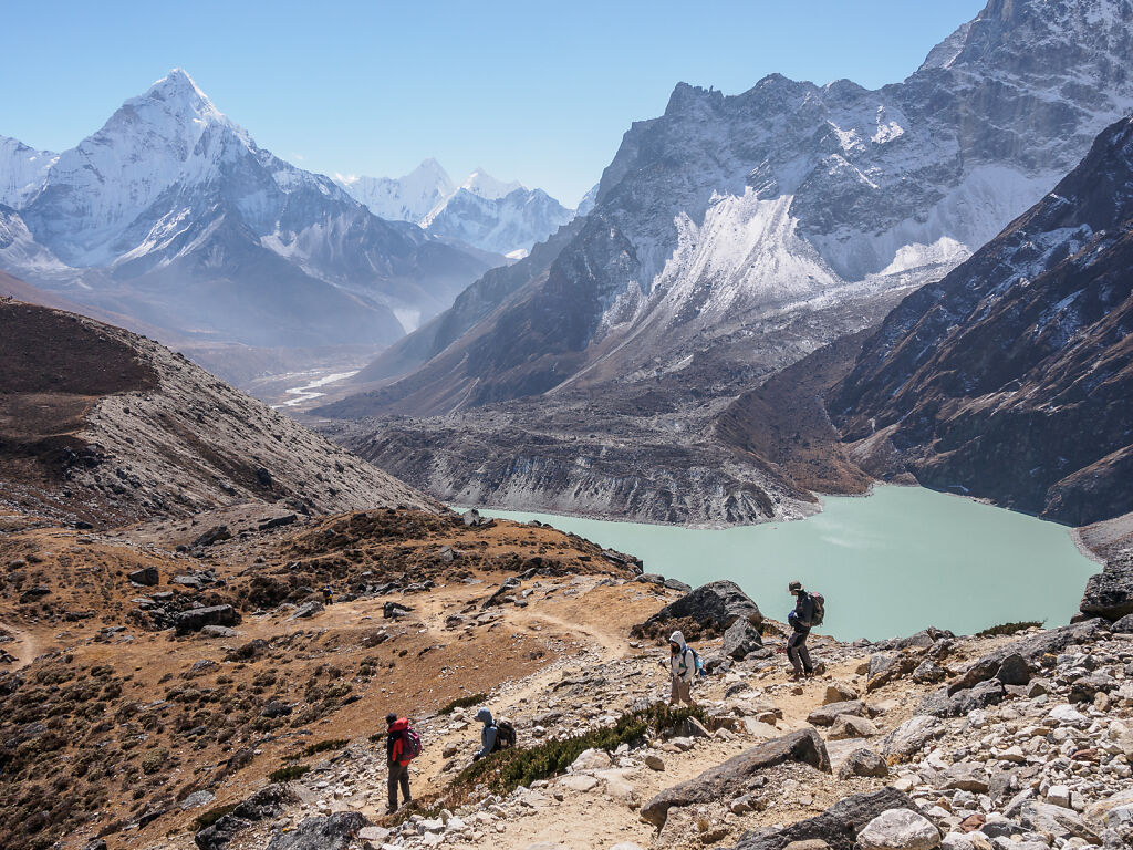
A meditating yak near Dudh Pokhari - Gokyo 3rd Lake
-

Gokyo in the morning. Lodge owners lay blankets outside to dry in the sun every day. Mt. Pharilapche (6017 m) is above.
-

Hiking up north from Gokyo. Behind is Gyachung Kang (7952 m) - the highest mountain below 8000m.
-

Mount Everest from Scoundrel's Viewpoint. From this angle one can see almost the entire North Face (left on the picture).
-

Mt. Cho Oyu (8201 m) is the 6th-highest mountain on the planet. A morning shot from Gokyo.
-

Gokyo in the morning. Mt. Pharilapche (6017 m) is to the left. Renjo La (pass) is up on the ridge to the right.
-

Morning reflections in Dudh Pokhari - Gokyo 3rd lake
-

Mt. Cho Oyu (8201 m) and Ngozumpa glacier from Gokyo
-

Sun rises over the Ngozumpa glacier. Cholatse, Taboche, Kangtega and Thamserku are on the horizon.
-

Crossing the Ngozumpa glacier on the way to Tagnak
-

Crossing the Ngozumpa glacier on the way to Tagnak
-

The climb up to Cho La (pass)
-

Hanging prayer flags at Cho La (5400 m)
-

Looking east from Cho La (pass). Mt. Lobuche and Lobuche East are above with Nuptse peering behind them.
-
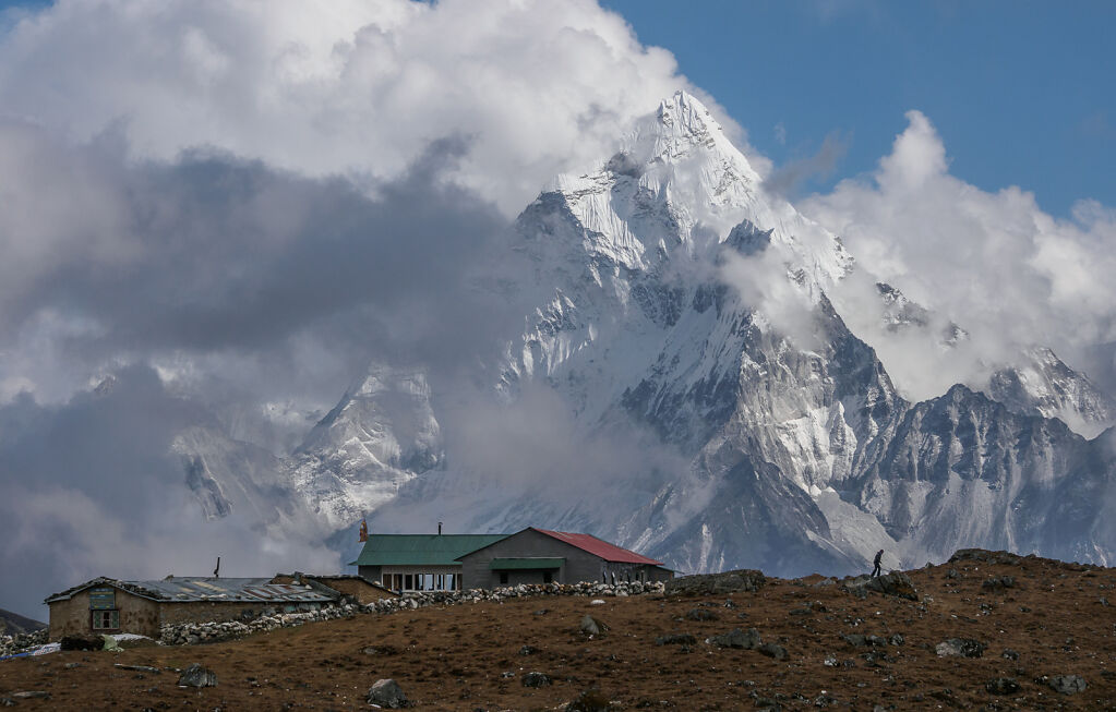
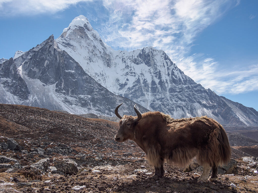
Mt. Ama Dablam (6812 m) dominates the view east of Cho La
-
Dzongla with Mt. Ama Dablam behind
-
Looking east from below Dzongla. To the right is Chola Tsho (lake).
-

The Everest trail just below Lobuche. On the horizon are Pumori, Lintren and Khumbutse - all on the border with Tibet (China)
-

Enjoying a late afternoon from the lateral moraine of Khumbu Glacier. The glacier itself is to the right. On the horizon are Pumori (7161 m), Lintren (6713 m), Khumbutse (6639 m), and Nuptse (7861 m)
-

Everest sunset from half way to Kala Patthar. The orange mountains on the horizon are Changtse, Everest's West Shoulder, Everest itself and Nuptse
-

Everest sunset from below Kala Patthar
-

Mt. Nuptse a minute before the sun set
-

Everest sunset from below Kala Patthar. This is less than a minute before the light goes out completely.
-

Kangtega (6782 m) - a view from Kala Patthar
-
The memorial site above Dughla.
-

Ama Dablam seen through the prayer flags of the memorial site above Dughla.
-

Ama Dablam (6812 m) from above Dingboche
-

A stupa on the hill above Dingboche
-
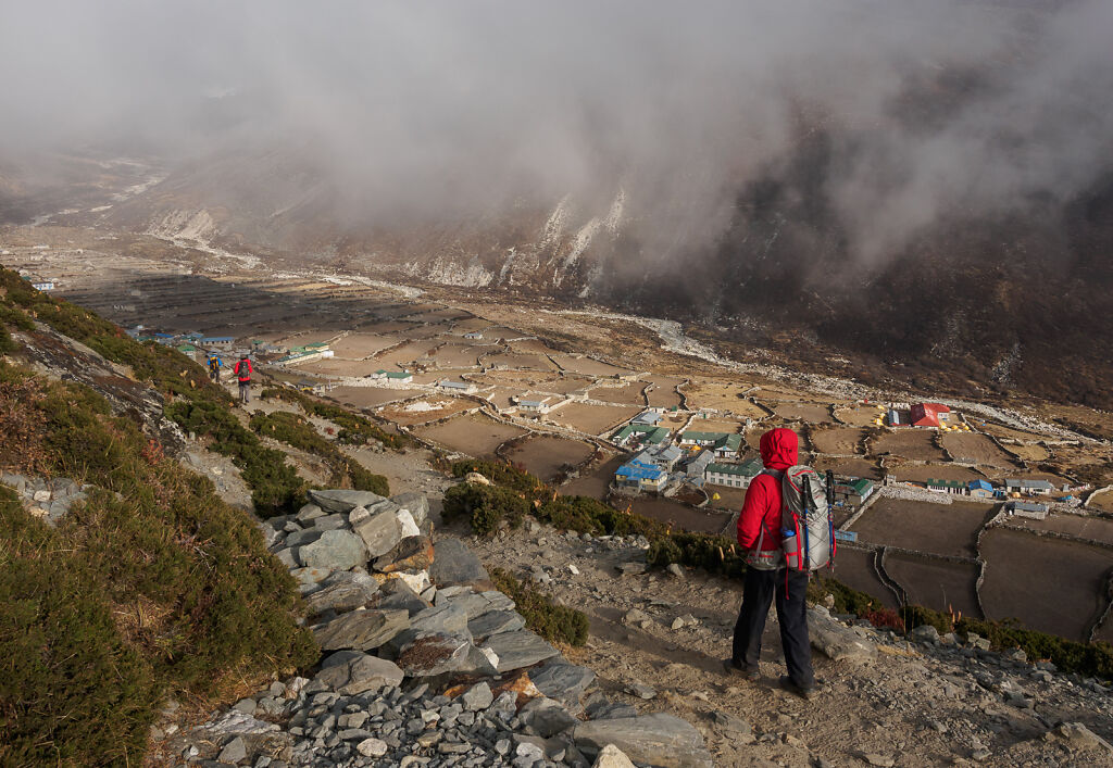
Dingboche (4400 m)
-

Imja Valley in the morning. Island Peak (6189 m) is the little pimple in the middle where the clouds seem to come from. The one to the left of it is Lhotse (8516 m). The red shrubs belowe are called sea-buckthorn. Local people make a very refreshing drink from it.
-
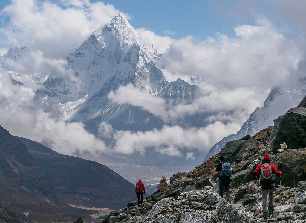
Ama Dablam (6812 m) from Chukhung
-

Looking back at Taboche (6542 m) from above Chukhung
-

2 nameless peaks south of Island Peak
-

Yaks coming back from Island peak base camp
-

Island Peak (Imja Tse) from the trail to the base camp. Some yaks (down to the right) are coming back from the camp.
-
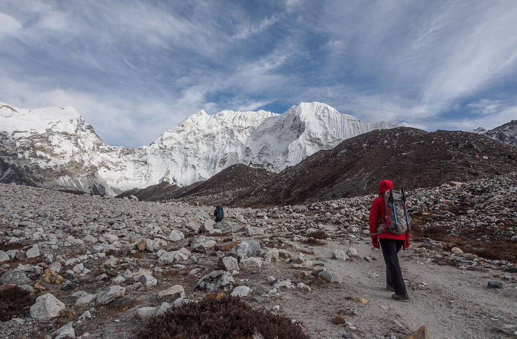
Approaching Island Peak base camp. The Baruntse-Kali Himal massif ( 7129 m) is the white one in the middle.
-

The Imja glacier melts and morphs into Imja Tsho (lake). The surreal silver color of this place comes from mica - a mineral that seems to cover everythjing in the valley.
-

Looking east from just above Island Peak base camp. Cho Polu (6735 m) is the dome-shaped mountain to the left. Num Ri (6677 m) is the one to the right. Imja glacier flows down at the bottom-right corner of the picture.
-

Island Peak base camp at sunset
-

A night shot from Island Peak base camp. The peak itself is not visible from here.
-

Moon rising over Island Peak base camp
-
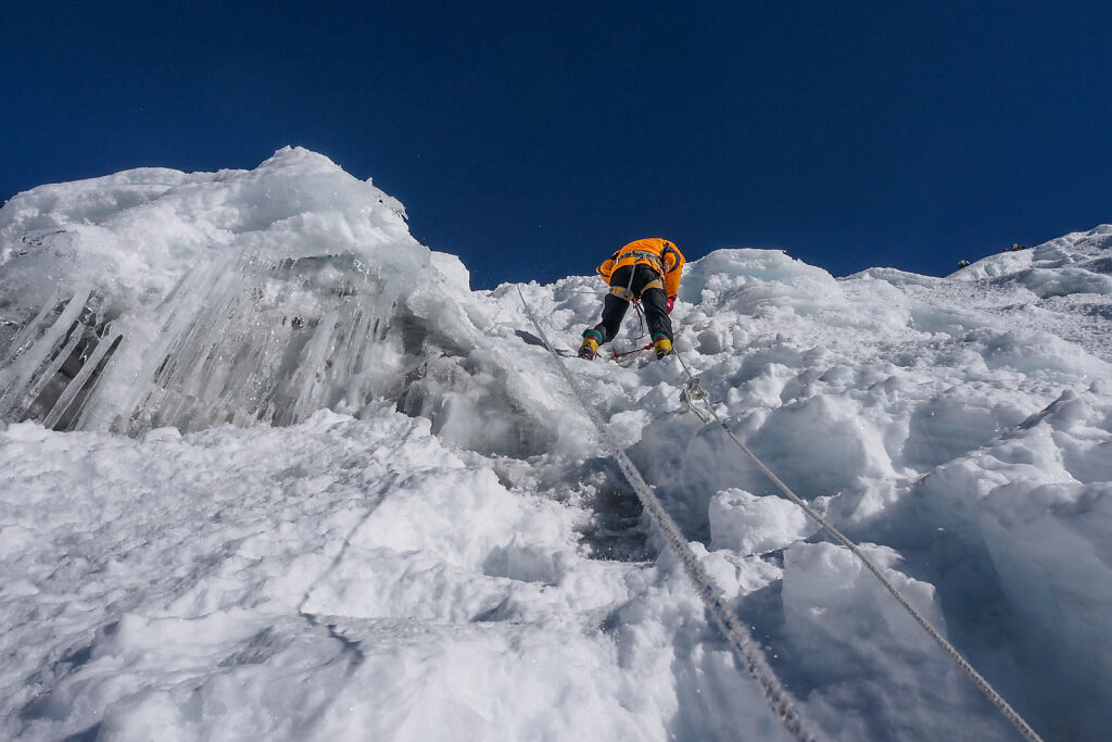
The steepest part of the ice wall of Island peak
-

Looking back from the ridge of Island Peak
-

Island Peak's summit
-

Happy on top of Island Peak ;-)
-

Climbers navigate the crevasses and the plateau below the summit of Island Peak
-

The crevasses below Island Peak
-
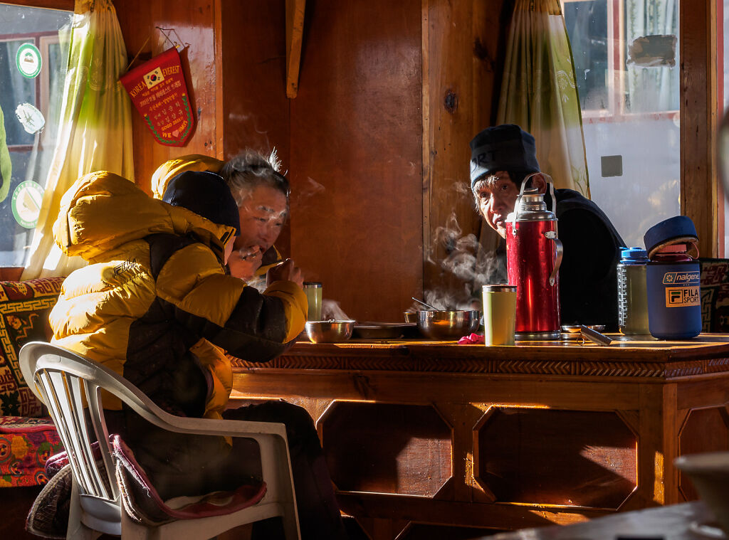
Climbers having breakfast in a Pangboche lodge
-

A stupa mirroring Ama Dablam's perfect shape. Shot from the trail to Pangboche.
-

Inside the Tengboche monastery
-

Ama Dablam (6812 m) seen through the gate of Tengboche monastery
-

A vendor selling kitchenware to the Khumbu villages. Shot on the trail above Namche.